This Google Earth time lapse (see link above image below) from 1984 to present shows the need for Green Belt protection, and how protective green belt government policies have been doing there job in recent decades.
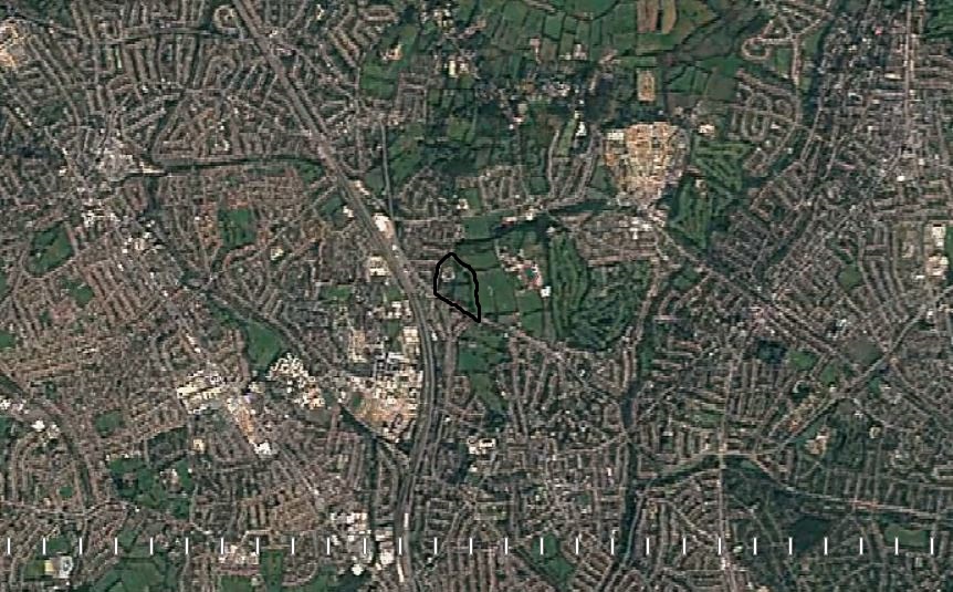
From the Time Lapse map we can see how expansive, dense and developed are the areas of Colindale, Edgware, Finchley and Hendon, encircling the site, such a view puts into perspective why the Green Belt needs to be protected, and especially here.
The proposed site (Copthall South Fields) are the last large area of wild open public Green Belt land in this part of the Copthall Estate, everything else on the Estate has been leased out to various sports clubs or businesses – resulting in fields adjacent which are drained, manicured, mown and not inviting for wildlife – which the Copthall South Fields currently are. You will even find a mini theme park here now … Metro Golf Centre.
This bit of Green Belt reaches down to FiveWays Corner – and acts as a green lung, worryingly the location has been recognised as above EU limits for air pollution, as found in a recent joint project by Mapping for Change and UCL (funded by Barnet Council).
Measurements taken in this Air Quality Management Area (AQMA) under the Five Ways Corner flyover NW7 were: µg/m³ 58.88, EU limits are: µg/m³ 40, this a polluted part of London.
https://communitymaps.org.uk/project/air-quality-monitoring/contribution/16103?tab=1¢er=51.6017:-0.2349:16
Area exceeding EU pollution limits –
The site provides Green Lungs to help counter pollution, not just here in Barnet, but for the inner areas of London, The Mayors Air Quality Strategy:
https://www.london.gov.uk/…/air_quality_strategy_v3.pdf
1.1.4. states:
‘Pollution blown in from outside London contributes significantly to problems in the capital. In central London, around 40 per cent of PM10 concentrations are caused by emissions from outside the capital.
A similar proportion of NO2 concentrations across London are caused by emissions not generated in the capital.’
A recent survey by Mapping for Change at UCL, funded by Barnet Council found air quality at the Five Ways Junction to be above EU limits. (see document F1).
Measurements taken in this Air Quality Management Area (AQMA) under the Five Ways Corner flyover NW7 were: µg/m³ 58.88, EU limits are: µg/m³ 40, this a polluted part of London.
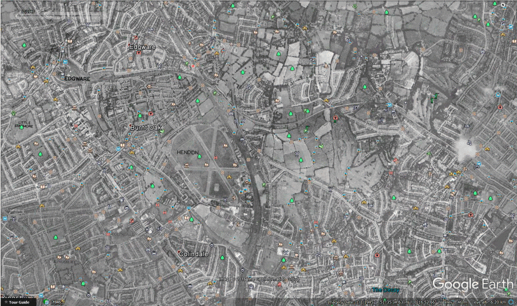
This gif shows the rapid development around the site, dates 1945, 2003-present:
Follow this link, click ‘slow’ just under the changing date.
https://earthengine.google.com/timelapse/
Proposed site is circled in black on this map:


